Crossing the Dream Valley (Cont.)
Dejen and the ‘Abay’ Gorge (Part 2)
…
Chancho, Muke Turi, Fiche, and Gebre Guracha are among the drive-by small towns. These used to be pit stops for tea and bathroom breaks back in the day. There's less need for them now. We fly by them as if they don't exist. In all honesty, there isn't much to them; and there's almost nothing new. They're the same old "sprinkles of the Oromia region," I call them. Frantically established congregations along the opposite sides of the transnational highway roads. They're linear and align everything by the roadside. The crown jewel of my memory at these stops is a very underappreciated beverage called 'Lewz Shay.' Arabic speakers might guess this, but it translates to "Peanut Tea." And that's just what it is, a hot, rich, creamy peanut drink. It is one of the most warming and nourishing things I have ever had when done right. It's a shame that this isn't a commonplace drink in the city's cafés and coffee shops.

Road to Gojjam in the Oromia region (2022)
Copyright © Nahom Assefa 2023
It was around 3,000 meters above sea level around here. Until this point, the roads are scenic and typical of the region. Grassy meadows with occasional peaks and some savannah-like landscapes make you yearn for something different. Then comes the buffer zone that transitions from green plateaus to dry gorges. There's an unforgiving overlap of high temperatures and sunny hours during these trips when we reach the Abay gorge.
Gohatsion is a pleasant sight I consider unique in its appearance. What shapes a small, and somewhat isolated town, into such an anomaly? I haven't gotten to the very bottom of it. I have reason to believe it is an elevated oasis that starts to mark the boundary between green pastures and arid valleys. Happy villages where the children play outside on any given day, where goats and donkeys roam around or take on their daily tasks, paint the broader strokes of my memory. This village is the gateway, mind you, because what lies ahead is far from pretty while it lasts.

The 'Abay' gorge (2022)
Copyright © Kidus Assefa 2023
Oh dear, hold on now. It's time to slow down gears and put your best driving expertise forward. The roads are built on mountain edges coiling against the slope. One wrong turn and one slip could spell disaster for surrounding vehicles. This road has almost folklore status and is shrouded with legends and mysteries. It is a difficult road passing a region highly susceptible to landslides. Driving accidents, and massive erosion, I might have even heard of bandit presence in the area. My grandmother once mentioned surviving a bus flip from this suspended tightrope. Highways are built on a tight, stingy budget here. Two narrow opposing lanes are the best you can get cross-country. Plenty of logistical network links pass by here, trucks, shipment container hauling vehicles, construction machinery, and all sorts of vehicles. This route is a primary transportation link between two regions and beyond the north, way past our final stop. Frustrated coaster and mini-bus drivers become fidgety after hours of tension. The only apparent option that gets you where you want to go is passing those in front of you. You must, then, risk overlapping them by switching lanes. Accelerate, decelerate, left, then back right… that's the routine. It's more of a gamble when there are a series of cliffs and blind zones.
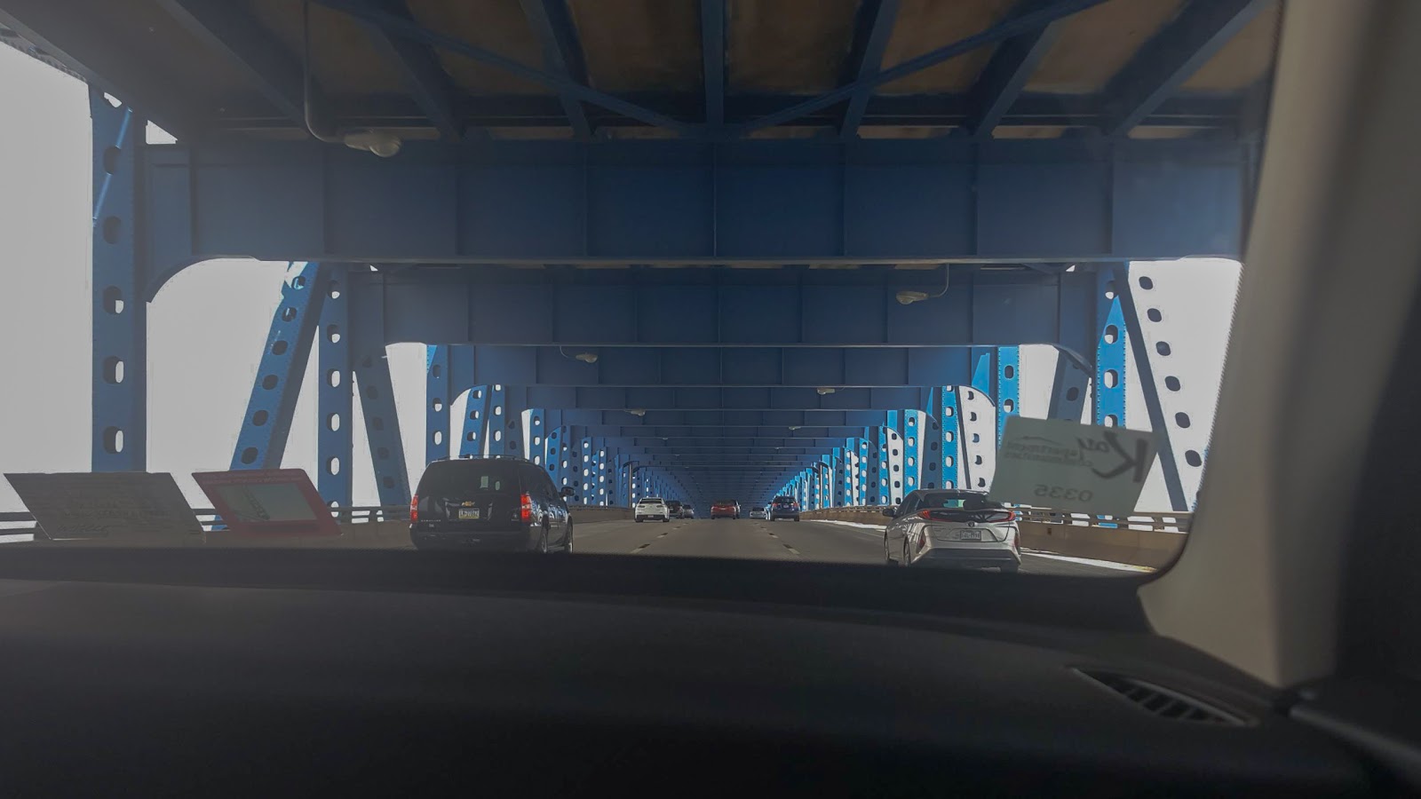
After driving a short distance downhill, the horizons broaden. Despite its dwindling volume, the mighty Nile's early beginnings cut through the landmass. The water has diminished drastically to where it is now. It has left more land for us to navigate to cross as best we can. We soon reached the crossing bridge. It is a very iconic photo background. It is a lulling journey; some patience is required to make it through without bitter and beaten energy. There are lots of Baboons from here on, although the lower troughs have more in larger groups. Perhaps it's the time of the day. Something about this place resembles the wild western landscape. We continued towards the other side of the Nile, where the uphill road became increasingly steeper.

The 'Abay' bridge over the Blue Nile (2022)
Copyright © Nahom Assefa 2023
So we prevailed again and made the crossing successfully. This side of the Abay Gorge is somewhat a mirror of the other. More goats and settlements come into view. Small churches, which seem to have withstood the test of time for so long, pop up. I am more endeared when I see the village children hustling tourists and passersby. Well, they sell the tangerines and bananas they pick. You can tell you are just about to enter Dejen once the roads become leveled. This town is the first significant stop on the remainder of this highway. However, it is where our journey ends today. I can almost feel my great-grandmother's presence as we approach the peripherals of this humble town. I associate this part of the road with the young girls with shaved heads who fetch water and other goods. Upon entering Dejen, we are welcomed by the town's most prominent church and mosque on symbolically opposite sides of the road. Following that come the trucks, buses, and hauling vehicles. We go past a few blocks and take a right. A short drive in, another left, and we arrived. Near the cliff edge, on the verge of seeing our missed relatives who scramble to receive us with royal hospitality. It never gets old.

'Afaf' Cliff, Dejen (2022)
Copyright © Nahom Assefa 2023


Comments
Post a Comment